|
Advantus® Federal Labor Law Poster
Avoid government penalties and fines up to $10,000 by posting federal labor law posters. Posters contain all required notices. Laminated. Free Update Notification Service offered. Federal poster is 24...
|
|
Advantus® State/Federal Labor Law Poster Combo Pack
Avoid government fines up to $10,000 by posting these laminated federal and state labor law poster which include all the required notices within your workplace. Keep up to date with the free update no...
|
|
Advantus® U.S. & World Physical Political Map
Printed on tear-resistant Kimdura....
|
|
Advantus® United States Physical Political Map
Printed on tear-resistant Kimdura....
|
|
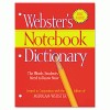
Advantus® Webster'S Notebook Dictionary
This handy dictionary is three-hole punched to fit into a binder for easy access and portability at home or at school. Features clear, concise definitions of the words students need to know—more...
|
|
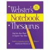
Advantus® Webster'S Notebook Thesaurus
Smart notebook style is three-hole punched to fit into a binder for easy portability and access. Authoritative and up-to-date, it features 50,000 synonyms and antonyms. Easy-to-read page design and si...
|
|
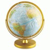
Advantus® World Globe
Physical and political map with raised relief and a full swing meridian. Shows natural coloration of the earth to illustrate mountains, deserts, forests and grasslands. Blue oceans show undersea physi...
|
|
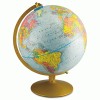
Advantus® World Globe W/Blue Oceans
Globe with raised relief includes thousands of locations and geographical features highlighted with bright contrasting colors. Mounted on a gold-toned semi-meridian and base....
|
|
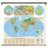
Advantus® World Physical Political Map
Printed on tear-resistant Kimdura. Seven color shades illustrate land elevation and water depth. Political information includes state and national boundaries, capitals, major cities, lakes and mountai...
|
|
American Map® 2007 Large Type U.S. Road Atlas
Larger scale, easier reading. Includes U.S. and Puerto Rico. Major city inset maps, on-page locator map and mileage table. Features national park finder map, scenic routes, interstate maps, elevation ...
|
|
American Map® 2007 Standard U.S. Road Atlas
Colorful, easy-to-read road maps of the U.S., Canada, Mexico and Puerto Rico. Inset maps of major U.S. cities. Features national parks finder and on-page locator maps, plus mileage tables for major ci...
|
|
American Map® 2008 Atlas De Carreteras
First edition of a standard atlas with text in Spanish. Features colorful, easy-to-read road maps of the U.S., Canada, Mexico, and Puerto Rico with 3-D elevation shading....
|
|
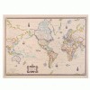
American Map® Cleartype® Antique World Map
Full-color graphics printed on parchment colored paper....
|
|
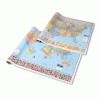
American Map® Cleartype® Full-Color Rolled U.S. And World Political Paper Map Set
World map shows all counries plus towns and time zones....
|
|
American Map® Concise World Atlas
Learn more about the world around you with this concise world atlas. The atlas has 70,000 entries, including world population statistics and all the time zones....
|
|
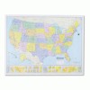
American Map® Hammond Deluxe Laminated Rolled Political Map
Improved digital cartography Relief shading illustrates physical details Color bands make political boundaries immediately distinguishable Write on with dry erase or china marker (sold separately), wi...
|
|
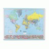
American Map® Hammond Deluxe Laminated Rolled Political Reference World Map
Detailed full-color digital cartography. Flags border the bottom of the map....
|
|
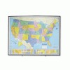
American Map® Heritage™ Full-Color Laminated Framed Political Map
Pinnable, write-on/wipe-off surfaces recommended for use with map tacks and dry erase markers (not included). Sizes given are approximate, including frame....
|
|
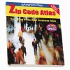
American Map® U.S. Zip Code Atlas
Full-color county/town zip code map included. Full-page state maps show three-digit zip code areas with five-digit areas keyed to maps. Features 22 pages of demographic data. Includes updated zip code...
|

|
Carson-Dellosa Publishing Guiness World Records™ Math
Grab your students' attention with full-color photos. This series features word problems with wild, wacky, and wonderful Guinness World Records™ such as the tallest chocolate sculpture and t...
|
|
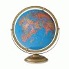
Cram 16" Political Globe
Lots of place names and information make this an ideal reference tool and teaching resource for the classroom. Color scheme makes locating countries easy. A global perspective with American craftsmans...
|
|
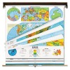
Cram Intermediate Physical/Political Eight-Map Set
Space-saving, cost-effective map set supplies in-depth physical and general political information for all the world's land masses and bodies of water. Winkel map projection ensures the best possib...
|
|
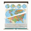
Cram Intermediate Political Eight-Map Set
Save space and cut costs when you choose this compact, economical, comprehensive map set. Each chart utilizes the Winkel III projection, universally recognized as the most accurate two-dimensional pro...
|
|
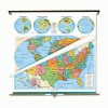
Cram Intermediate Political United States And World Map Combo
Map set is ideal for classrooms where visual geographic reference materials would be useful. World map utilizes ultra-accurate Winkel projection, and both maps feature the most up-to-date information....
|
|
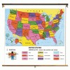
Cram Intermediate Political United States Map
Designed specifically for grades 4 through 12, this combination map features bright, contrasting state colors that help simplify intermediate and advanced social studies lessons. State capital, city a...
|
|
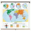
Cram Intermediate Political World Map
Large, easy-to-read political map utilizes the Winkel III projection system to produce the most accurate chart available in relation to area and distance scale as well as elliptical alignment and thre...
|
|
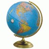
Cram Madison 12" Political Globe
Essential reference tool for classroom, home or office. Color scheme makes locating countries easy. A global perspective with American craftsmanship. Quality materials tested for durability....
|
|
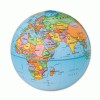
Cram Political Globe
Contrasting colors for countries, blue-colored oceans, raised relief geographical features and hundreds of place names. Mounted on a gold-tone metal swing meridian and base....
|
|
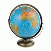
Cram Taylor 12" World Globe
Shows extensive physical characteristics of the world, as well as political boundaries. Depicts under-ocean contours, two water depths and five elevations! A global perspective with American craftsman...
|

|
Cram United States And World Starter Map Combo
Cost-effective, compact, simplified map set is designed for preschool and grades K through 2. World map utilizes ultra-accurate Winkel projection, and both maps feature the most up-to-date information...
|


